Lighthouses
| Name | Image | Location | Coordinates | First Lit | Automated | Deactivated | Current Lens | Focal Height |
|---|---|---|---|---|---|---|---|---|
| Avery Rock Light |  |
Machias Bay | 44.654°N 67.344°W | 1875 | 1926 | 1947 (Destroyed) | N/A | 56 ft |
| Baker Island Light | 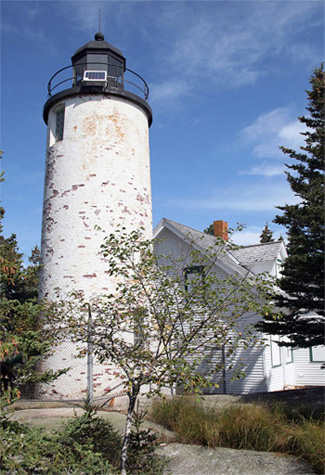 |
Cranberry Isles (Baker Island) | 44.2381°N 68.1990°W | 1828 (Former) 1855 (Current) |
1966 | Active | Fourth-order Fresnel | 105 ft |
| Bass Harbor Head Light | 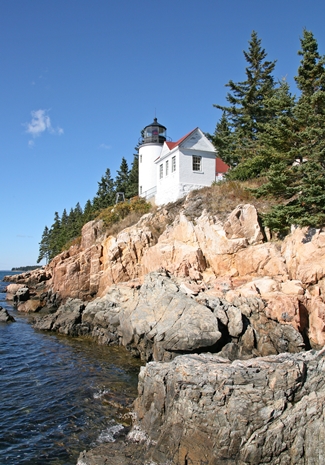 |
Tremont (Mount Desert Island) | 44.2218°N 68.3373°W | 1858 | 1974 | Active | Fourth-order Fresnel | 56 ft |
| Bear Island Light | 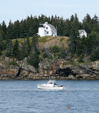 |
Cranberry Isles (Bear Island) | 44.2838°N 68.270°W | 1839 (Former) 1889 (Current) |
1989 | Active (Inactive 1981-1989) | Plastic | 100 ft |
| Blue Hill Bay Light |  |
Blue Hill (Blue Hill Bay) | 44.2489°N 68.4988°W | 1857 (Former) 1935 (Current) |
1935 | 1935 (Former) Active (Current) |
Unknown | 25 ft |
| Boon Island Light |  |
York | 43.1214°N 70.4764°W | 1811 (Former)1855 (Current) | 1980 | Active | VRB-25 | 137 ft |
| Browns Head Light |  |
Vinalhaven (Browns Head) | 44.1118°N 68.9095°W | 1832 (Former) 1857 (Current) |
1987 | Active | Fifth-order Fresnel | 39 ft |
| Burnt Coat Harbor Light |  |
Swan’s Island | 44.1341°N 68.4472°W | 1872 | 1975 | Active | Unknown | 75 ft |
| Burnt Island Light |  |
Boothbay Harbor | 43.8252°N 69.6402°W | 1821 | 1988 | Active | Electrified Beacon | 61 ft |
| Cape Elizabeth Lights (East Tower) |  |
Cape Elizabeth (Casco Bay) | 43.5661°N 70.2001°W | 1874 | 1963 | Active | VRB-25 | 129 |
| Cape Elizabeth (West Tower) |  |
Cape Elizabeth (Casco Bay) | 43.5642°N 70.2025°W | 1828 | Never | 1924 | Unknown | |
| Cape Neddick Light |  |
York | 43.1652°N 70.6078°W | 1879 | 1987 | Active | Forth-order Fresnel | 88 ft |
| Crabtree Ledge Light | 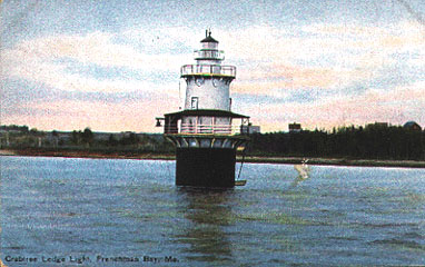 |
Frenchman Bay | 44.470°N 68.203°W | 1890 | Never | 1933 (Destroyed in 1950) | None | 37 ft |
| Cuckolds Light |  |
Boothbay Harbor (Cuckold Islets) | 43.7795°N 69.6500°W | 1892 (Former) 1907 (Current) |
1972 | Active | VRB-25 | 59 ft |
| Curtis Island Light |  |
Camden (Penobscot Bay) | 44.2014°N 69.0489°W | 1835 (Former) 1896 (Current) |
1972 | Active | Unknown | 52 ft |
| Deer Island Thorofare Light |  |
Stonington (Penobscot Bay) | 44.1344°N 68.7033°W | 1857 | 1958 | Active | 250mm | 52 |
| Dice Head Light | 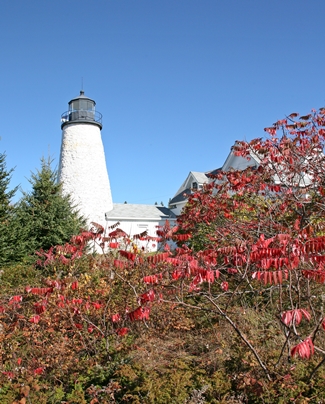 |
Castine | 44.3827°W 68.8186°W | 1829 | 1937 | Active (Inactive 1937-2007) | Unknown | 134 ft |
| Doubling Point Range Lights (Front) | 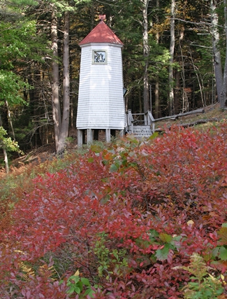 |
Arrowsic (Arrowsic Island) | 43.8828°N 69.7957°W | 1898 | 1980 | Active | Unknown | 18 ft |
| Doubling Point Range Lights (Rear) | 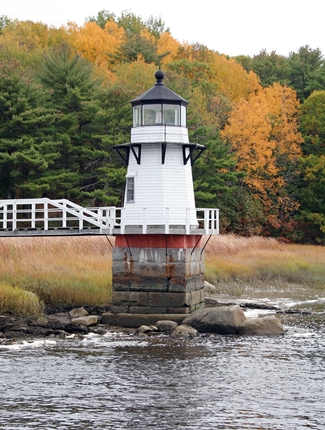 |
Arrowsic (Arrowsic Island) | 43.8848°N 69.7957°W | 1898 | 1980 | Active | Unknown | 33 ft |
| Eagle Island Light | 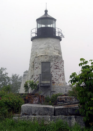 |
Eagle Island (Penobscot bay) | 44.2176°N 68.7678°W | 1838 (Former) 1858 (Current) |
1959 | Active | Fourth-order Fresnel | 23 ft |
| Egg Rock Light |  |
Frenchman Bay | 44.3539°N 68.1383°W | 1875 | 1976 | Active | VRB-25 | 64 ft |
| Fort Point Light |  |
Stockton Springs (Penobscot River) | 44.4671°N 68.8117°W | 1836 (Former) 1857 (Current) |
1988 | Active | Fourth-order Fresnel | 88 ft |
| Franklin Island Light |  |
Franklin Island (Muscongus Bay) | 43.8921°N 69.3746°W | 1805 (Former) 1855 (Current) |
1967 | Active | 250mm | 57 ft |
| Goat Island Light |  |
Kennebunkport (Cape Porpoise) | 43.3579°N 70.4251°W | 1835 (Former) 1859 (Current) |
1990 | Active | 300mm | 38 ft |
| Goose Rocks Light |  |
North Haven (Penobscot Bay) | 44.1354°N 68.8307°W | 1890 | 1963 | Active | 250mm | 51 ft |
| Great Duck Island Light |  |
Frenchboro (Great Duck Island) | 44.1420°N 68.2458°W | 1890 | 1986 | Active | VRB-25 | 67 ft |
| Grindle Point Light |  |
Islesboro | 44.2814°N 68.9431°W | 1874 | 1934 | 1987 (Inactive 1934-1987 | 250mm | 67 ft |
| Halfway Rock Light |  |
Casco Bay | 43.6558°N 70.0368°W | 1871 | 1975 | Active | VRB-25 | 76 ft |
| Hendricks Head Light |  |
Southport (Sheepscot River) | 43.8226°N 696897°W | 1829 (Former) 1875 (Current) |
1951 | Active (Inactive 1933-1951 | 250mm | 43 ft |
| Heron Neck Light |  |
Vinalhaven (Penobscot Bay) | 44.0251°N 68.8622°W | 1854 | 1984 | Active | Fifth-order Fresnel | 92 ft |
| Indian Island Light |  |
Rockport | 44.1655°N 69.0610°W | 1850 (Former) 1875 (Current) |
Never | 1934 | None | Unknown |
| Isle Au Haut Light |  |
Isle Au Haut | 44.0647°N 68.6514°W | 1907 | 1934 | Active | 250mm | 48 ft |
| Ladies Delight Light |  |
Winthrop, Maine (Lake Cobbosseecontee) | 1908 | 1930s | Active | Unknown | 25 ft | |
| Libby Island Light |  |
Machiasport (Machias Bay) | 44.5683°N 67.3674°W | 1822 (Former) 1848 (Current) |
1974 | Active | VRB-25 | 91 ft |
| Little River Light |  |
Cutler | 44.6509°N 67.1921°W | 1846 (Former) 1876 (Current) |
1975 | Active (Inactive 1975-2001) | VRB-25 | 56 ft |
| Lubec Channel Light |  |
Lubec | 44.8421°N 66.9766°W | 1890 | 1939 | Active | 155mm | 53 ft |
| Machias Seal Island Light |  |
Machias Seal Island | 44.30678°N 67.6679°W | 1832 | 59 ft | |||
| Marshall Point Light |  |
Port Clyde | 43.9174°N 69.2613°W | 1832 (Former) 1858 (Current) |
1908 | Active | 300mm | |
| Matinicus Rock Light |  |
Matinicus Isle | 43.7835°N 68.8550°W | 1827 (Former) 1846 (Current Towers) |
1983 | 1924 (North Tower) Active (South Tower) | VRB-25 | 90 ft |
| Monhegan Island Light |  |
Monhegan | 43.7648°N 69.3158°W | 1824 (Former) 1850 (Current) |
1959 | Active | VRB-25 | 178 ft |
| Moose Peak Light | 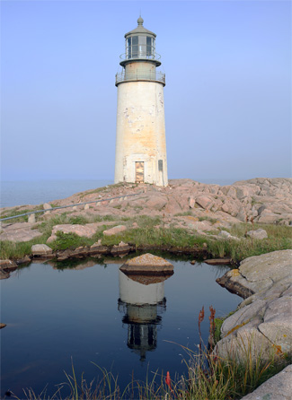 |
Mistake Island | 44.4746°N 67.5320°W | 1827 (Former) 1851 (Current) |
1972 | Active | DCB-24 | 72 ft |
| Mount Desert Light | 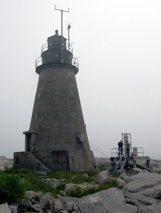 |
Mount Desert Rock | 43.9686°N 68.1283°W | 1830 (Former) 1847 (Current) |
1977 | Active | VRB-25 | 75 ft |
| Narraguagus Light | 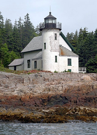 |
Narraguagus Bay | 44.456°N 67.8312°W | 1853 | Never | 1934 | None | 54 ft |
| Nash Island Light | 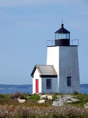 |
Pleasant bay | 44.4643°N 67.7473°W | 1838 (Former) 1874 (Current) |
1958 | 1982 | None | 51 ft |
| Owls Head Light | 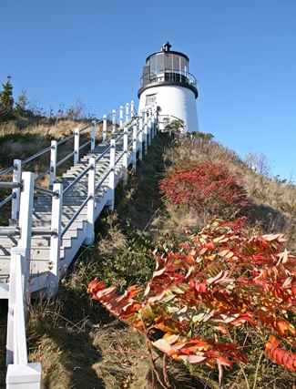 |
Owls Head (Penobscot Bay) | 44.0922°N 69.0440°W | 1825 | 1989 | Active | Fourth-order Fresnel | 100 ft |
| Pemaquid Point Light | 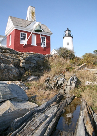 |
Bristol | 43.8368°N 69.5058°W | 1827 (Former) 1857 (Current) |
1934 | Active | Fourth-order Fresnel | 79 ft |
| Perkins Island Light |  |
Georgetown (Perkins Island) | 43.7868°N 69.7852°W | 1898 | 1959 | Active | 250mm | 41 ft |
| Petit Manan Light | 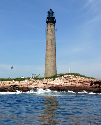 |
Millbridge (Petit Island) | 44.3676°N 67.8644°W | 1817 (Former) 1855 (Current) |
1972 | Active | VRB-25 | 123 ft |
| Pond Island Light |  |
Kennebec River | 43.7400°N 69.7703°W | 1821 (Former) 1855 (Current) |
1963 | Active | 250mm | 52 ft |
| Portland Breakwater Light |  |
South Portland | 43.6555°N 70.2349°W | 1855 (Former) 1875 (Current) |
1934 | Active (Inactive 1942-2002) | Unknown | 30 ft |
| Portland Head Light |  |
Cape Elizabeth (Casco Bay) | 43.6231°N 70.2079°W | 1791 | 1989 | Active | DCB-224 | 101 ft |
| Prospect Harbor Point Light |  |
Gouldsboro (Prospect Harbor) | 44.4034°N 68.0130°W | 1850 (Former) 1891 (Current) |
1951 | Active | Optic | 42 ft |
| Pumpkin Island Light |  |
Deer Isle (Pumpkin Island) | 44.3092°N 68.7428°W | 1854 | Never | 1933 | None | Unknown |
| Ram Island Ledge Light |  |
Cape Elizabeth (Casco Bay) | 43.6315°N 70.1874°W | 1905 | 1959 | Active | Third-order Fresnel | 77 ft |
| Ram Island Light |  |
Boothbay Harbor | 43.8038°N 69.5992°W | 1883 | 1965 | Active | Unknown | 36 ft |
| Rockland Harbor Breakwater Light |  |
Rockland | 44.1040°N 69.0775°W | 1827 (Former) 1902 (Current) |
1964 | Active | VRB-25 | 39 ft |
| Rockland Harbor Southwest |  |
Rockland | 44.45768°N 69.54664°W | 1987 | Active (Privately owned) | Fifth-order Fresnel | 44 ft | |
| Saddleback Ledge Light |  |
Saddleback Ledge (Penobscot Bay) | 44.0144°N 68.7264°W | 1839 | 1954 | Active | 300mm | 54 ft |
| St. Croix River Light |  |
St. Croix River | 45.1282°N 67.1338°W | 1857 (Former) 1976 (Current) |
1976 | Active | Unknown | 77 ft |
| Seguin Light |  |
Georgetown | 43.7075°N 69.7580°W | 1795 (Former) 1857 (Current) |
1985 | Active | First-order Fresnel | 180 ft |
| Spring Point Ledge Light | 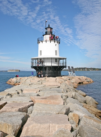 |
South Portland | 43.6521°N 70.2239°W | 1897 | 1934 | Active | Fifth-order Fresnel | 54 ft |
| Squirrel Point Light |  |
Arrowsic (Arrowsic Island) | 43.8165°N 69.8024°W | 1898 | 1982 | Active | 250mm | 25 ft |
| Tenants Harbor Light |  |
St. George (Southern Island) | 43.9611°N 69.1849°W | 1857 | Never | 1933 | None | 27 ft |
| Two Bush Island Light |  |
Two Bush Island (Penobscot Bay) | 43.9642°N 69.0739°W | 1897 | 1964 | Active | VRB-25 | 65 ft |
| West Quoddy Head Light | 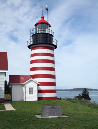 |
Lubec | 44.8151°N 66.9507°W | 1808 (Former) 1858 (Current) |
1988 | Active | Third-order Fresnel | 83 ft |
| Whaleback Light | 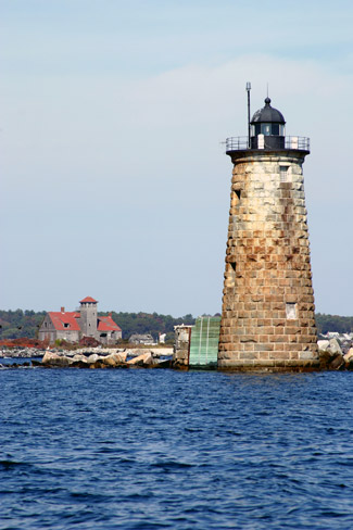 |
Kittery (Piscataqua River) | 43.0588°N 70.6863°W | 1820 (Former) 1872 (Current) |
1963 | Active | VLB-44 | 59 ft |